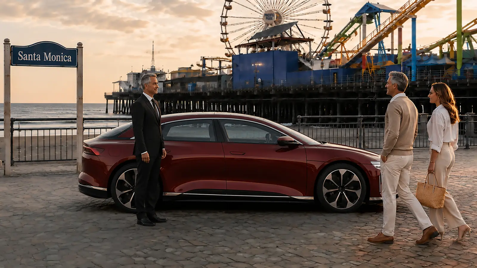
Private driver greeting a couple beside a red sedan near the Santa Monica Pier.

Private Driver in Santa Monica

Santa Monica driving sounds simple until a day touches the Pier, the Promenade, the hotels, the tech offices, and LAX all at once. We send a private driver to operate your own vehicle across Santa Monica and the rest of Los Angeles County.

Service Area · Serving Santa Monica and all of Los Angeles County
★★★★★ 5.0 100% 5-star Google reviews

Hover to pause and read

Touch to pause and read

The Level Ledger Starts With Six Santa Monica Nouns

The six working nouns are bluff, grid, structure, deck, sand, and highway. Bluff means the Ocean Avenue and Palisades Park elevation. Grid means the downtown streets above the shore. Structure means a numbered municipal garage or a named private facility. Deck means the Pier platform. Sand means a lower beach lot or an Ocean Front Walk connection. Highway means Pacific Coast Highway beneath the bluff.

Each noun requires its own action. A bluff meeting receives a cross street. A grid destination receives a block face. A structure receives a number and pedestrian exit. A deck visit receives a reunion landmark. A sand appointment receives a lot or path. A highway movement receives a named entrance. The Level Ledger keeps those pairings visible from the first departure through the automobile's final placement.

Ocean Avenue Is Recorded as a Bluff Address

Ocean Avenue belongs to the upper city. It borders Palisades Park and reaches hotels, residences, restaurants, and downtown properties, yet it is not a continuous beach access lane. The ledger therefore adds the property name, cross street, entrance, passenger door, and intended direction to every Ocean Avenue address. “Ocean Avenue near the water” leaves too many lawful possibilities.

A hotel near Colorado Avenue creates a different automobile decision from a residence near Montana Avenue or a park meeting opposite Broadway. When the next commitment is below the bluff, the upper address remains the first entry and the chosen descent becomes a second entry. Separating those two records prevents the shoreline portion from silently replacing the hotel or residence handoff.

The California Incline Is an Elevation Entry

The California Incline converts the Ocean Avenue level into the Pacific Coast Highway level near California Avenue. In the Level Ledger, it is not merely a road name. It is an elevation entry with a starting height, an ending height, a highway direction, and a specific lower destination. That distinction matters when the automobile begins North of Montana and the first appointment sits beside the shore.

The most direct descent is not automatically the best sequence. The assigned employee considers the required lower entrance, the next fixed stop, and the direction needed after collection. If the schedule returns to the upper city soon afterward, the ledger preserves that return transition before the automobile descends. The client can then see why a short visual distance may contain two separate coastal movements.

"We have built our reputation one client at a time. If any part of your experience falls short of what you expected, I will make it right. You have my word, and every client has my mobile number."

Pacific Coast Highway Needs an Entrance Noun

Once the automobile reaches Pacific Coast Highway, a vague beach reference is no longer sufficient. The useful noun might be the Annenberg Community Beach House, a numbered beach lot, the Pier district, or a stated Ocean Front Walk connection. The ledger attaches that noun before the coastal segment begins, because a passed entrance can require considerable correction.

Highway direction belongs beside the entrance noun. The same destination may produce a different approach from the north and the south, especially when a median, project control, crowd, or active public instruction limits a turn. Posted signs and lawful controls govern the actual movement. A last-minute message changes the ledger only after the replacement location is precise enough to reach without guesswork.

The Pier Has a Construction-Date Field

The Santa Monica Pier is undergoing a bridge replacement project scheduled to continue into 2027. A temporary pedestrian bridge opened in June 2026 just south of the former Ocean Avenue entrance, while the established automobile entrance from Ocean Avenue is closed during the project. That makes the date of the Pier instruction as important as the familiar destination name.

For a Pier visit, the Level Ledger records the city project notice reviewed for the service date, the open pedestrian approach, the agreed deck landmark, and a lawful automobile reunion point outside any restricted work area. Temporary closures can occur as construction advances. Barriers, public personnel, and posted controls always replace an older plan, even when a previous visit used another connection.

“At the Pier” Is Divided Into Deck, Bridge, and Lower Shore

The Pier district contains several meeting heights. A person can finish near Pacific Park on the deck, at the temporary pedestrian bridge, beside Ocean Front Walk, or near a lower beach lot. Those positions may appear almost identical on a phone screen while requiring entirely different movement by automobile and on foot.

The ledger assigns one height before the party separates. It also gives the person a stable visual noun such as a named attraction, bridge end, approved walkway, or lot reference. If the finish changes, the new noun and height are sent together. That convention is particularly useful when children's belongings, beach bags, purchases, or event materials make a needless bluff climb impractical.

In a client's words
“Excellent, professional service! Makes it so easy to get to and from big events in LA and anywhere you may want to go. Without them, I might be too hassled to drive myself and stay home.... So, thanks for getting me our there to enjoy all LA has to offer! Omar has been exceptional and every driver we have had in the past is top notch! Josef, the owner, is great to work with making sure all details are perfect and the quality of is company is strongly upheld. Surprisingly, inexpensive pricing. I recommend tipping very well.”

★★★★★
lisa Firestone
Five-Star Google Review

Colorado Avenue Is No Longer Treated as the Old Pier Formula

Colorado Avenue still reaches the Pier area, but the bridge project means an old instruction cannot be copied automatically. The Level Ledger distinguishes the Colorado block on the downtown grid from the pedestrian bridge used under the current project arrangement. It never promises automobile access merely because Colorado historically led to the Pier entrance.

A downtown meal followed by a Pier walk can begin at a structure, continue on foot toward Colorado, and end at another lawful collection point. The ledger keeps the structure number, walking exit, Pier landmark, and final automobile position as four separate facts. This prevents the word “Colorado” from concealing a change between grid, bridge, deck, and lower shore.

Third Street Promenade Creates a Pedestrian Boundary

Third Street Promenade moves automobile planning to the district's edge. A store, cinema, office, or restaurant on the pedestrian blocks is paired with the boundary street the client expects to use afterward. The Level Ledger records that exit before the visit begins, so the assigned employee does not have to interpret a message sent from somewhere inside a long pedestrian corridor.

Wilshire Boulevard, Arizona Avenue, Santa Monica Boulevard, Broadway, and Colorado Avenue divide the Promenade area into distinct cross-street choices. A single block can change the useful downtown structure or the next turn. Purchases are handled from a lawful collection position on the chosen boundary, not by treating the pedestrian pavement as an automobile lane.

Structure 1 and Structure 2 Form an East-West Pair

The city lists Parking Structure 1 at 1234 Fourth Street and Parking Structure 2 at 1235 Second Street. Their street numbers are close, but their exits place the automobile on different sides of the Promenade. The Level Ledger uses the complete structure number and address rather than the phrase “the downtown garage.”

The pedestrian destination decides which side of the pair is useful; the commitment after downtown decides whether that choice still makes sense. A party heading toward the bluff may prefer a different column from one continuing inland. If the automobile moves while the client is inside, the updated structure number, floor, and pedestrian-facing street replace the original record immediately.

Structure 4 Is a Second Street Coordinate

Parking Structure 4 is listed by the city at 1321 Second Street. The Level Ledger treats “4” as a coordinate, not as a count or floor. That language avoids a common ambiguity when a client says “level four” while the assigned employee understands “Structure 4.” The written entry separates structure number from interior floor every time.

Second Street also places the automobile west of the pedestrian core. A visit near Ocean Avenue, Santa Monica Place, or the western side of the Promenade may make that position useful, while a later inland obligation may favor another exit. The ledger chooses the structure through the full sequence rather than through walking distance alone.

Structure 5 Belongs to the Fourth Street Column

The city lists Parking Structure 5 at 1431 Fourth Street. Its Level Ledger entry includes Structure 5, the interior floor, the chosen pedestrian exit, and the street direction needed afterward. Each field has a separate label because a single number cannot describe all four facts reliably.

Fourth Street is on the inland side of the Promenade. That can suit a schedule moving toward Lincoln Boulevard, the freeway terminus, or an eastern neighborhood after downtown. It can be less useful if every following obligation lies at the bluff edge. The assigned employee reads the structure as part of a directional chain rather than as a generic place to wait.

Structure 8 Creates a South-Downtown Record

Parking Structure 8 is listed at 1555 Second Street. Its position near the southern portion of downtown gives the Level Ledger another precise alternative for Santa Monica Place, Colorado Avenue, and nearby blocks. The record still requires the interior floor and the pedestrian exit because “Structure 8” gets the automobile to the building, not necessarily to the person.

For a sequence that begins downtown and continues toward Main Street or the Civic Center area, a southern structure can reduce an unnecessary reversal. For a sequence returning North of Montana, another coordinate may be stronger. The next fixed noun governs the choice. That is the difference between a numbered Santa Monica structure strategy and a general parking paragraph.

Structure 9 Anchors the North-Downtown Edge

Parking Structure 9 is listed at 1136 Fourth Street, north of Wilshire Boulevard. It can serve a northern downtown appointment without placing the automobile deep inside the central blocks. The Level Ledger states Structure 9, Fourth Street, the interior floor, the pedestrian route, and the northbound or southbound intention after collection.

This coordinate can also support a transition toward California Avenue or Montana Avenue. It should not be selected merely because its number is remembered. Availability, posted conditions, the client's walking path, and the next named commitment still decide. The record captures those current facts without turning a municipal structure into a guaranteed waiting place.

More than 90% of our business comes from repeat clients.

Ken Edwards Center Is Written as a Name, Not a Number

The Ken Edwards Center parking structure is listed by the city at 1527 Fourth Street. Because its name differs from the numbered structures, the Level Ledger writes the complete facility name and address. That prevents an abbreviation from being misheard as an interior level or an unrelated downtown building.

Its Fourth Street position may complement a nearby civic, retail, dining, or meeting commitment. The useful exit depends on the next item in the schedule. Current posted conditions determine entry, payment, occupancy, and lawful use. The page does not freeze a rate or availability promise into text that may remain online after the municipal rules change.

Palisades Park Is Indexed by Cross Street

Palisades Park extends along the bluff, so its name alone cannot identify a collection point. The Level Ledger adds the nearest cross street and a stable public feature. Colorado Avenue, Santa Monica Boulevard, Wilshire Boulevard, California Avenue, and Montana Avenue mark very different portions of the linear park.

A walker may begin near the Pier overlook and finish much farther north. In that case, the ledger contains both the opening marker and the expected finish marker. The assigned employee positions the automobile only where the curb and posted controls permit. The park's edge remains a pedestrian place; planted ground and protected bluff areas never become invented automobile shortcuts.

The California Avenue Bluff Entry Differs From the Incline

“California” can refer to California Avenue on the upper grid, a Palisades Park meeting near that avenue, or the California Incline descending toward the highway. The Level Ledger expands the noun so those three meanings cannot collapse into one message. Each receives its own level and purpose.

A client finishing a bluff walk might mean the park edge at California Avenue, while an employee preparing for a shoreline appointment might need the Incline. One instruction concerns a person on foot; the other concerns a change in automobile elevation. Writing both entries in full prevents a short local term from sending the two parties to parallel positions.

Annenberg Beach House Uses a Facility-and-Overflow Entry

The Annenberg Community Beach House has its own first-come parking area at 415 Pacific Coast Highway. The city identifies Beach Lots 8 and 9 to the south and Will Rogers State Beach to the north as alternatives when that area is full. The Level Ledger records the facility, program, expected exit, and selected parking location as separate items.

A pool session, cultural program, meeting, or private gathering can release people through different parts of the property. The client names the activity and sends any facility instruction received for that date. If the first choice is unavailable, the replacement lot is written into the ledger before the parties separate. “Near Annenberg” is not used as a substitute for the actual overflow destination.

Your car, protected. Your trust, earned. The Your Car Our Driver promise.

North Beach Lot Numbers Replace “Somewhere Above the Pier”

The shoreline north of the Pier contains distinct parking areas with separate approaches from Pacific Coast Highway. The Level Ledger uses the posted lot number and a stable internal reference such as the payment area, row, or approved pedestrian connection. It does not reduce the entire northern shoreline to a broad beach label.

Direction remains part of the record. The automobile may need to leave northbound, return toward the Incline, or continue to another Santa Monica level. A shoreline outing that ends after sunset also benefits from a preselected illuminated landmark. Exact lot language keeps the person from searching one parking area while the automobile occupies another.

Ocean Front Walk Is a Pedestrian Line, Not a Curb Promise

Ocean Front Walk links waterfront destinations for people on foot and on permitted small devices. Its address can identify a place on the lower shore without identifying an automobile position. The Level Ledger therefore pairs the Ocean Front Walk noun with a lawful nearby lot, street connection, facility entrance, or current Pier project approach.

When the client walks north or south along the beach, the start and finish are recorded independently. A moving phone location can help confirm direction, but it does not create a curb on a pedestrian path. The final written noun must still be a place the household automobile can lawfully reach and the client can recognize from ground level.

Montana Avenue Is Divided by Storefront Block

Montana Avenue works through short, named commitments: a particular storefront, salon, café, office, or household errand. The Level Ledger uses the business name, block, side of the avenue, expected duration, and next residential turn. That vocabulary is more useful than a generic reference to shopping on Montana.

An afternoon can combine several Montana blocks before ending at a North of Montana home. The assigned employee sequences those nouns so the automobile does not repeatedly reverse direction. If an appointment extends, the revised finish time is attached to that storefront entry. The other Montana obligations remain visible instead of being lost inside a broad neighborhood label.

North of Montana Requires the Correct Residential Gate

North of Montana properties can have sloped approaches, multiple gates, service entries, and quiet streets where repeated circulation is inappropriate. The Level Ledger adds the authorized gate, key location, automobile starting position, household contact, and required final placement to the street number.

The home, the automobile, and the keys can occupy different positions at the beginning of an assignment. Those facts are verified separately. At the end, “return home” is expanded into the requested entrance and automobile orientation. A nearby intersection is not considered a completed residential return when the household has specified another lawful placement on its property.

Main Street Is Checked Against the Santa Monica Boundary

Main Street approaches Venice near the southern city line, where district names can blur even though street numbers remain exact. The Level Ledger states the business number, nearest cross street, and municipality. Ocean Park Boulevard, Hill Street, Ashland Avenue, and the blocks nearer Rose Avenue create different southbound and northbound decisions.

For a meal or shop collection, the client identifies the door and messages before stepping outside. The assigned employee approaches the permitted block face once the exit is certain. The record then states whether the automobile returns north through Santa Monica, continues south into Venice, or turns inland. This boundary vocabulary belongs specifically to the lower Main Street sequence.

Ocean Park Is a Neighborhood and a Boulevard

Ocean Park can mean a neighborhood, a boulevard, or a destination carrying the same words. The Level Ledger does not allow that shared name to stand alone. A residence receives its street number and entry; an Ocean Park Boulevard business receives its block face; a beach connection receives its lower-shore noun.

This distinction becomes important when a local schedule crosses between Main Street, Lincoln Boulevard, Cloverfield Boulevard, and the residential grid. The fixed address determines which meaning is active. The assigned employee can then preserve the most coherent direction without assuming that every Ocean Park reference belongs at the shoreline.

Bergamot Is Written as Campus, Organization, and Exit

Bergamot contains galleries, creative organizations, event activity, and the nearby E Line station around Olympic Boulevard and 26th Street. The Level Ledger uses the organization or building name, the internal meeting point, the campus exit, and the following direction. A general “Bergamot” entry does not distinguish an exhibition from a station collection.

Openings and programs can fill internal approaches. When that occurs, the client and a vetted W-2 employee use a preselected lawful public-street alternative. The next destination may lie in downtown Santa Monica, along Olympic Boulevard, or beyond the eastern city edge. Naming the exit keeps the arts-campus handoff from borrowing the logic of the Promenade or beach.

Three Keys of Trust

Visibility

Share a live tracking link with anyone you choose so they can follow your vehicle's location in real time.

Communication

Reach your driver by cell.

Assurance

Reach our Chairman and CEO by cell.

The Interstate 10 Terminus Becomes a Grid Choice

Interstate 10 ends inside Santa Monica, so the regional freeway segment concludes before the local arrival is complete. The Level Ledger adds the first useful city street, the final block, and any structure entrance to the freeway entry. Lincoln Boulevard, Fourth Street, Fifth Street, and Cloverfield Boulevard can lead to different Santa Monica branches.

On an eastbound departure, the starting level matters. An automobile at the beach must first reach the upper grid or another lawful connection before entering the freeway sequence. An automobile already east of downtown may need no bluff transition. The ledger makes that hidden local distance visible rather than describing the entire trip as “taking the 10.”

Santa Monica Airport Carries an End-Date Note

Santa Monica Airport remains part of current city geography, and the city has reaffirmed permanent closure at midnight on December 31, 2028. The Level Ledger places that date beside any present aviation appointment. It also records the named operator, exact entrance, flight schedule, baggage detail, and responsible contact supplied for the service date.

No current appointment is treated as proof of future availability. A later request requires a fresh status check because provider arrangements and airport access can change before the closing date. This end-date note gives Santa Monica aviation its own decision rule and prevents the page from presenting today's airfield as a permanent destination.

The Automobile Remains a Familiar Base

The assignment takes place in the client's suitable sedan, SUV, or other household automobile. Beach clothing, work material, purchases, mobility items, and personal settings remain together while the schedule moves between Santa Monica levels. The owner supplies lawful registration, a roadworthy condition, fuel or charge, keys, and instructions for any unusual controls.

An assigned company employee operates the automobile and communicates directly by cell. The household may also name an authorized contact for schedule changes. Private-driver service does not include emergency response, clinical care, lifting assistance, medication supervision, or any escort a facility requires. Any help beyond automobile operation is arranged separately by the client.

Reserved Time Supports Level Changes

Santa Monica service is arranged by reserved time in the client's automobile. The quote states the hourly basis, applicable minimum, and any agreed parking, toll, or other expense. Crowd size at the Pier or Promenade does not create surge pricing.

Added time depends on availability and client authorization. A level change, construction detour, extended program, or delayed restaurant finish can alter the schedule, so direct notice matters. The Level Ledger is updated with the new end signal and final automobile placement before the reservation extends.

Build the Reservation From the Hardest Santa Monica Noun

Begin with the stop most likely to cause a level error: the temporary Pier approach, a numbered downtown structure, a Pacific Coast Highway entrance, an Annenberg overflow lot, a Palisades Park cross street, a Bergamot organization, or a North of Montana gate. Add the fixed appointment and the destination that follows it.

Then identify the automobile, keys, passenger count, belongings, authorized contacts, and required final placement. The company can organize the remaining entries around those facts. The resulting reservation is not a generic coastal itinerary. It is a Santa Monica Level Ledger built from bluff height, structure numbers, pedestrian boundaries, named shoreline entrances, a freeway terminus, and the client's actual doorway.

Questions about private driver service?

Search our answers, or jump straight to the questions people ask.

See all questions →

Areas We Serve

North of Montana and Ocean Park, plus the Pier, Pacific Park, Santa Monica State Beach, the Third Street Promenade, Santa Monica Place, Montana Avenue, Main Street, Palisades Park, Tongva Park, Bergamot Station, and the Ocean Avenue hotels.

Airports

LAX as the natural airport, Van Nuys for private aviation, and Santa Monica Airport for some general-aviation needs while available.

Local Knowledge

The hard part is the density. The Pier, the Promenade, the beach traffic, and the 10 ending at the coast mean parking and curb timing decide the day.

Your Car Our Driver serves Santa Monica and every community across Los Angeles County, Orange County, and Riverside County.

Clear, consistent rates

Simple pricing, no surprises.

Your own sedan or SUV starts at $60 / hour, larger vehicles at $66 / hour, with a three-hour minimum on every booking, a five-hour minimum for reservations beginning at or after 6:00 p.m. on New Year's Eve. No surge pricing, ever.

See full pricing