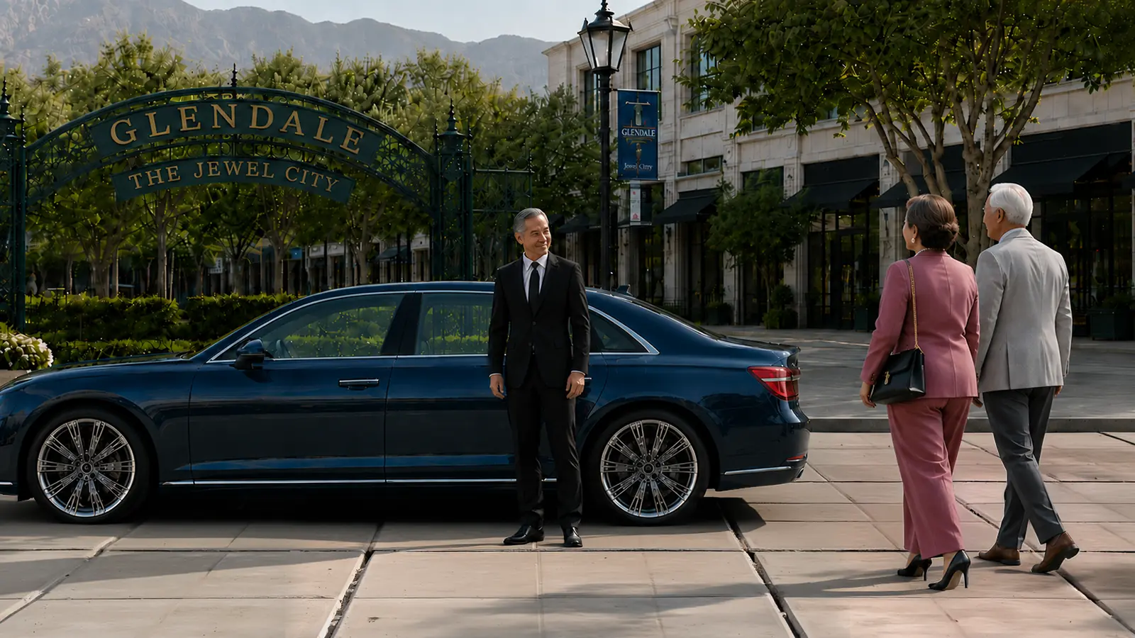
Private Driver in Glendale
A Glendale day runs through Brand Boulevard, the Americana, the Galleria, downtown offices, medical appointments, and the hillside neighborhoods. We send a private driver to operate your own vehicle rather than bringing a marked car.
Service Area · Serving Glendale and all of Los Angeles CountyHover to pause and read
Touch to pause and read
The Glendale Door Index Begins With the Block Face
The Glendale Door Index pairs a destination with the block face that actually receives the passenger. Brand Boulevard, Central Avenue, Artsakh Avenue, Broadway, Wilson Avenue, Harvard Street, Mountain Street, Honolulu Avenue, and North Verdugo Road can place the same destination name in very different circulation conditions. The useful instruction includes the property, entrance, side, and next commitment.
A pin does not identify a garage exit, theater door, hospital pavilion, library entrance, or foothill property approach. A vetted W-2 employee works from the Door Index so the automobile is positioned for the passenger's purpose, not merely near the postal address.
Four Municipal Structures Form a Downtown Parking Vocabulary
Glendale operates the Exchange, Marketplace, Orange Street, and Civic Center parking structures. Those four names create a municipal vocabulary that should remain separate from the private retail garages around The Americana at Brand and Glendale Galleria. A client who says only downtown garage has not identified the correct automobile location.
The reservation states the structure name, entrance street, remembered level or section, pedestrian exit, and next meeting point. This structure vocabulary makes the stored automobile easy to locate after a meeting, performance, library visit, civic appointment, or sequence along Brand Boulevard.
Exchange Means North Artsakh Avenue
The Exchange Parking Structure is located at 115 North Artsakh Avenue. It belongs to the north side of the Artsakh corridor near the Alex Theatre end. An Exchange entry should preserve the North Artsakh name, the structure level, the pedestrian exit used, and the destination that follows.
When a performance or downtown appointment ends, the passenger may be closer to Brand Boulevard, Wilson Avenue, Broadway, or Artsakh Paseo than to the original garage door. A message naming the present block face allows the automobile to leave Exchange for the new lawful meeting point without sending the passenger back through the structure.
"We have built our reputation one client at a time. If any part of your experience falls short of what you expected, I will make it right. You have my word, and every client has my mobile number."
Marketplace Means South Artsakh Avenue
The Marketplace Parking Structure is located at 120 South Artsakh Avenue. Its south position places it closer to the Central Library and Harvard Street end of the corridor. Marketplace is therefore not a casual substitute for Exchange, even though the two structure names appear on the same avenue.
The Door Index records Marketplace, South Artsakh, the pedestrian exit, and the next property. That wording distinguishes a library visit, Central Park Paseo activity, Brand Boulevard meal, or shopping stop from an Exchange-based theater evening north of Broadway.
Orange Street Has a Separate Exit Logic
The Orange Street Parking Structure is located at 222 North Orange Street, west of Brand Boulevard. Its street approach and pedestrian exits create a different downtown pattern from the Artsakh structures. The automobile may emerge on the correct side for a Central Avenue commitment while the passenger has walked toward Brand.
An Orange Street instruction includes the actual destination beyond the structure. Office tower, restaurant, hotel, retail entrance, or theater meeting each produces a different next block. The structure name locates the automobile; the destination noun locates the passenger.
Civic Center Parking Serves an Isabel and Broadway Calendar
The Civic Center facility primarily supports city employees and visitors to City Hall. A civic calendar should name the department, public counter, meeting room, or building entrance rather than using downtown Glendale as the destination. Broadway, Isabel Street, Glendale Avenue, and the municipal campus define this part of the Door Index.
A permit appointment, council meeting, records visit, or city-service errand may finish at a different door from the arrival. The responsible contact sends the updated civic door before requesting the automobile. That keeps a government-building release separate from an Artsakh or retail pickup.
Artsakh Paseo Is a Pedestrian Segment, Not a Through Street
Artsakh Paseo occupies North Artsakh Avenue between Wilson Avenue and Broadway as a pedestrian-friendly public space. Its programming can alter the relationship between the Exchange structure, Alex Theatre, Brand Boulevard, and the surrounding blocks. The passenger's event point belongs inside the paseo; the automobile remains on an available public approach outside it.
The index therefore records the nearest open cross street and the side chosen for reunion. A festival, community viewing program, public-art activity, or ordinary walk through Artsakh Paseo can change where the passenger emerges. Wilson and Broadway provide two distinct end nouns.
Alex Theatre Anchors the North End of the Arts Corridor
The Alex Theatre stands near the north end of the downtown arts corridor. Its marquee, lobby, stage program, and closing crowd produce a theater-specific sequence. The reservation states the performance, curtain time, expected conclusion, Exchange or other automobile location, and post-program block face.
The useful departure cue comes after the passenger reaches the selected side of the block. Artsakh Avenue, Brand Boulevard, Wilson Avenue, and Broadway can each serve a different post-theater movement. The Alex name alone does not select among them.
Central Library Anchors the Harvard Street End
Glendale Central Library is located at 222 East Harvard Street, south of Broadway. A research visit, meeting, children's program, public event, or collection appointment belongs to the Harvard Street end of downtown rather than the theater end. Marketplace and Central Park Paseo may be relevant, but neither replaces the library entrance.
The library entry records the program, participant, expected conclusion, belongings, and next Glendale noun. If the passenger walks north through Artsakh Paseo or west toward Brand Boulevard afterward, the changed block face is confirmed before the automobile is requested.
Brand Boulevard and Central Avenue Create Parallel Downtown Lines
Brand Boulevard carries storefronts, dining, offices, cultural properties, and the city's highest-priced curb meters. Central Avenue forms a parallel line serving offices, hotels, garages, and the western side of the retail district. Moving from one line to the other requires a cross street and a decision about which frontage receives the passenger.
Broadway, Wilson Avenue, California Avenue, and Colorado Street divide those parallel lines into usable segments. The Door Index pairs the destination with one of those crossings. This prevents a restaurant or office on Brand from being treated as though its easiest automobile access were automatically on Brand.
The Americana and Glendale Galleria Are Adjacent but Separate Systems
The Americana at Brand and Glendale Galleria sit next to each other, yet each has its own entrances, internal paths, parking choices, storefronts, and closing pattern. A passenger can walk between the properties while the automobile remains committed to a garage exit that cannot copy the pedestrian route.
The reservation names the exact store, restaurant, cinema, office, plaza point, or department-store frontage. It also names the automobile's actual structure. The words Americana, Galleria, Brand, and Central are retained in full so an adjacent destination does not become an assumed shared entrance.
A Retail Crossing Needs Two Confirmations
A person may enter through The Americana, cross toward Glendale Galleria, and finish on a third downtown block. The first confirmation identifies the automobile's stored location. The second identifies the passenger's present block face after the retail crossing. Neither message is useful if it says only outside the mall.
Packages, garment bags, personal items, and mobility equipment can remain arranged in the client's automobile. The passenger decides which purchases may stay inside and whether cargo space must be preserved for a later Glendale stop. The structure location and current passenger location stay as two separate facts.
Central Park Paseo Has a Brand Boulevard Address
Central Park Paseo is located at 220 South Brand Boulevard near Glendale Central Library. Its public space, nearby cultural uses, and downtown events create a plaza-style meeting problem rather than a garage-only problem. The passenger identifies the program area and the open perimeter street that can lawfully receive the automobile.
Harvard Street, Brand Boulevard, and the route toward Marketplace create three nearby but different references. The Door Index states which reference controls the exchange. A public-space event can then remain distinct from a library visit or South Artsakh structure release.
The Museum of Neon Art Belongs to a South Brand Circuit
The Museum of Neon Art belongs to the South Brand cultural circuit. A museum visit may connect with Central Library, Central Park Paseo, dining, or another Artsakh destination, but it still requires its own admission time and exit point. The passenger gives notice after reaching the selected South Brand frontage.
Neon exhibitions and evening programs can end after the surrounding block has changed from daytime office activity to restaurant traffic. The index protects the South Brand noun and next cross street rather than reusing a morning meeting point that no longer suits the block.

Rossmoyne Uses Curving Streets and Historic-District Boundaries
Rossmoyne is Glendale's largest historic district, with hundreds of homes along gently curving streets and Nibley Park within the district. A Rossmoyne address should include the intended residential approach because the curved street pattern can make two nearby house numbers belong to different arrival lines.
The client identifies the property entrance, quiet meeting method, key location, and final authorized position. Nibley Park, Mountain Street, Glenoaks Boulevard, and the named residential street help place the property within Rossmoyne without turning the historic district into a generic hillside description.
Royal Boulevard Is a District Inside the Rossmoyne Story
Royal Boulevard Historic District contains a smaller group of homes on a curving, palm-lined portion of Royal Boulevard. Its relationship to Rossmoyne does not erase the need for a complete Royal Boulevard address. The Door Index retains both the district and the individual property instruction.
A hosted dinner, family visit, or recurring household appointment can use a quiet arrival cue rather than an unnecessary curb wait. The assigned employee approaches after confirmation and returns the automobile to the exact approved location. Royal Boulevard remains a residential noun, not a downtown staging instruction.
Cottage Grove Sits at the Foot of Adams Hill
Cottage Grove Historic District occupies a one-block stretch at the foot of Adams Hill. That location creates a lower-hill relationship between South Glendale streets and the slope above. A Cottage Grove address and an Adams Hill address may look close while requiring different final approaches.
The client states whether the automobile begins below the slope, on an Adams Hill street, or inside a property position with special clearance. The first public street and final return point are kept in the index. This gives Cottage Grove a distinct action instead of using Adams Hill as a loose neighborhood label.
Adams Hill Begins Above the South Glendale Grid
Adams Hill rises above the flatter South Glendale street system. A schedule may descend toward Glendale Memorial, Colorado Street, San Fernando Road, or a regional freeway connection. The important opening is the hill-to-grid transition, not the distant destination alone.
An unfamiliar property approach, limited turning space, or street-side parking can change that transition. The household supplies the preferred exit direction and final placement. The assigned employee follows current signs and lawful access rather than assuming the shortest map line is suitable.
Brand Park Contains Four Different Cultural Doors
Brand Park at 1601 West Mountain Street contains Brand Library and Art Center, Brand Studios, the Doctors House and Gazebo, and the Whispering Pine Tea House and Friendship Garden. A park name cannot choose among those cultural doors. The reservation retains the facility and the event or program occurring there.
Mountain Street establishes the park approach, while the internal property name establishes the passenger purpose. A gallery opening, recital, class, private gathering, garden visit, or historic-house program may use a different timing cue. The automobile follows the posted park circulation and the current facility instruction.

El Miradero Has a Library Clock and a Park Clock
Brand Library occupies El Miradero, the former Leslie C. Brand residence, within Brand Park. The library and art center has its own operating hours, while the surrounding park has a broader daily schedule. The client checks the current date and identifies whether the commitment belongs to the library, gallery, recital hall, or outdoor grounds.
The difference between the library clock and park clock matters when a program ends near a facility closing. Mountain Street, the library-side entrance, and the chosen passenger point remain separate parts of the index. The word Brand is never allowed to stand for every property in Brand Park.
The Doctors House and Friendship Garden Have Different Hosts
The Doctors House and Gazebo support a historic-property or hosted-event sequence. The Whispering Pine Tea House and Friendship Garden support another part of Brand Park. A participant may walk between nearby grounds, but the host, program, and automobile instructions remain distinct.
The booking identifies the responsible host, exact facility, closing cue, items leaving with the passenger, and Mountain Street return. Flowers, event materials, food containers, artwork, or extra passengers can alter the cabin arrangement. Those changes are confirmed before the final park release.
Glendale Narrows Riverwalk Has West and East Entries
Glendale Narrows Riverwalk has a west entry at 300 Paula Avenue near Sonora and an east entry at 900 Flower Street near Grandview. Those two endpoints create an unusually precise Glendale exchange. A person can follow the river path while the client's automobile remains on the public street system.
The reservation names Paula or Flower before the activity begins and supplies the alternate end. The passenger sends notice after reaching the selected entry area. West entry, east entry, Sonora, Flower, and Grandview are retained as exact river-edge vocabulary.
River Velocity Can Close the Riverwalk
The City notes that the Glendale Narrows Riverwalk parks and path may close based on current river velocity. That condition is specific to the river-edge facility. A closure converts the planned Paula-to-Flower exchange into an alternate public meeting outside the closed area.
The client checks current park status and nominates the alternate before departure. The assigned employee does not enter a closed facility or infer safety from visible weather elsewhere in Glendale. River velocity, not a generic traffic estimate, controls this part of the calendar.
The Riverwalk Includes an Equestrian Facility
Glendale Narrows Riverwalk is also classified as an equestrian facility and includes interpretive displays and two small parks. A household activity involving walkers, bicyclists, or horses may require different equipment and release responsibility. The booking identifies which activity applies and who controls the conclusion.
YCOD supplies transportation in the client's automobile. It does not provide animal handling, bicycle loading, recreation supervision, or equipment the household has not arranged. The Paula or Flower endpoint is confirmed only after the participant and responsible contact are ready.
Deukmejian Begins at Markridge Road
Deukmejian Wilderness Park is located at 3429 Markridge Road at Glendale's northern extremity. Its rugged acreage, canyon paths, Stone Barn Nature Center, ranger station, parking, picnic facilities, and high-elevation terrain create a Markridge schedule unlike downtown or Montrose.
The Markridge entry identifies the Stone Barn, a scheduled nature program, a trail activity, or the park center. The participant supplies the expected conclusion and alternate meeting point. Current park notices, fire conditions, and public closures govern access.
Stone Barn and the Open Space Keep Separate Schedules
Stone Barn Nature Center operates on posted days and hours that can differ from the surrounding Deukmejian open space. A program at the barn should not inherit the timeline of a longer canyon outing. The booking states Barn program, Markridge endpoint, participant, and responsible contact.
If a public closure, private event, or program change affects Stone Barn, the client selects the new lawful location. The assigned employee does not search an open-space path for a participant. The usable signal comes from the Markridge park-center area.
Deukmejian Elevation Changes the Meaning of Nearby
Deukmejian rises sharply from the park entry toward the San Gabriel Mountains. A point that appears nearby on a flat map may belong to a very different elevation and path segment. The passenger meeting remains at an identified public endpoint, not a mobile location within Dunsmore or Cook's Canyons.
Footwear, water, outdoor supplies, and a change of clothing can be arranged in the household automobile before the Markridge arrival. The passenger confirms what returns from the outing and whether the cabin must accommodate another person or item afterward.
Montrose Uses Honolulu Avenue Blocks
Montrose Shopping Park follows Honolulu Avenue through a village-scale business district. Ocean View Boulevard and Verdugo Road provide strong local references, while individual shops, restaurants, public programs, and the Sunday market can move the passenger along several blocks.
The Montrose entry names the Honolulu block, cross street, business, and final reunion point. A person who walks from Ocean View toward Verdugo should not be asked to return automatically to the starting storefront. The current Honolulu position becomes the controlling noun.
Montrose Lots Are Not Downtown Structures
Montrose uses open municipal lots associated with Honolulu Avenue, Broadview Avenue, Florencita Avenue, and Verdugo Road. Those lots do not follow the Exchange, Marketplace, Orange Street, or Civic Center vocabulary used downtown. The automobile's Montrose lot and the passenger's Honolulu block are recorded separately.
A market, parade, seasonal program, or street closure can alter which lot is open. Current signs and city notices control. The alternate reunion point is placed on the same side of the affected Montrose area before the public program begins.
Three Keys of Trust
Visibility
Share a live tracking link with anyone you choose so they can follow your vehicle's location in real time.
Communication
Reach your driver by cell.
Assurance
Reach our Chairman and CEO by cell.
North Verdugo Road Connects Civic and Campus Doors
North Verdugo Road connects Glendale Civic Auditorium, Glendale Community College approaches, neighborhood streets, and movement toward Montrose and the foothills. A campus reference requires the specific building, lot, event, or passenger entrance because North Verdugo itself is only the connector.
The Door Index records the civic or campus noun and the direction that follows. A college appointment, auditorium program, neighborhood visit, or Montrose commitment can share North Verdugo while requiring a different final door and return side.
Three Medical Campuses Form a Glendale Triangle
Adventist Health Glendale, Glendale Memorial Hospital and Health Center, and USC Verdugo Hills Hospital occupy different parts of the Glendale-area map. The medical triangle identifies the exact campus, building, department, patient entrance, check-in time, release method, responsible contact, and next safe destination.
The private driver provides transportation only. Clinical decisions, medication, appointment participation, mobility assistance, discharge responsibility, and personal care remain with the client, family, caregiver, or provider. A required receiving adult must be identified before confirmation.
Glenoaks, Chevy Chase, and Oakmont Point to Different Slopes
Glenoaks Boulevard, Chevy Chase Drive, and Oakmont Country Club approaches belong to different parts of the eastern and northern slope system. A Glendale address near one of these names should retain the smaller residential street and the preferred direction toward the next arterial.
The vehicle's length, clearance, turning radius, garage opening, and key location may affect the property instruction. The client supplies those facts before the employee reaches the slope. A later return can use a different approved approach when lighting or household activity has changed.
The 134, 2, and 5 Divide Regional Commitments
The 134 links Glendale toward Burbank and Pasadena, the 2 connects hillside and Los Angeles directions, and the 5 serves broader north-south movement. A Glendale sequence identifies which freeway belongs to the fixed obligation and which surface street leads to the entrance.
An incident, closure, event, or ordinary congestion can change the lawful route. The authorized contact decides which commitment remains protected if the order must change. Brand Boulevard, Central Avenue, San Fernando Road, Glendale Avenue, and North Verdugo Road preserve the Glendale opening before the regional portion begins.
Complete the Glendale Door Index
Call or text YCOD with the date, Glendale property, household automobile, key location, passengers, first block face, exact entrances, stored-automobile location, fixed obligation, authorized contact, and final placement. Add Exchange, Marketplace, Orange Street, Artsakh, Brand, Harvard, Mountain, Paula, Flower, Markridge, Honolulu, or North Verdugo only when it actually controls the schedule.
We will identify missing Glendale nouns, review the time reserved, explain the quoted amount, and confirm whether the request fits the automobile and sequence. The completed Door Index should work from the first property instruction through the last Glendale block face.
Questions about private driver service?
Search our answers, or jump straight to the questions people ask.
See all questions →Areas We Serve
Brand Boulevard, The Americana at Brand, the Glendale Galleria, the Alex Theatre, the Brand Library and Art Center, Deukmejian Wilderness Park, Adventist Health Glendale, Glendale Memorial, USC Verdugo Hills, and the hillside neighborhoods of Verdugo Woodlands, Rossmoyne, Adams Hill, Glenoaks Canyon, Chevy Chase, and Oakmont.
Airports
Hollywood Burbank as the natural airport, with LAX when the flight schedule requires it.
Local Knowledge
The value is in the timing. Knowing which garage backs up, when Brand grinds to a stop, and how to route the 134, the 2, and the 5 is what keeps a day moving.
Nearby Communities
Your Car Our Driver serves Glendale and every community across Los Angeles County, Orange County, and Riverside County.
Simple pricing, no surprises.
Your own sedan or SUV starts at $60 / hour, larger vehicles at $66 / hour, with a three-hour minimum on every booking, a five-hour minimum for reservations beginning at or after 6:00 p.m. on New Year's Eve. No surge pricing, ever.
See full pricingYour car, driven in Glendale.
Reserve a private driver for an airport run, an evening out, an appointment, or a recurring schedule. For other communities we serve, see our Client Communities, or visit our FAQ for common questions.