“Great experience! Communication was amazing. I will definitely use this service again”
★★★★★
Anne Hackett
Five-Star Google Review

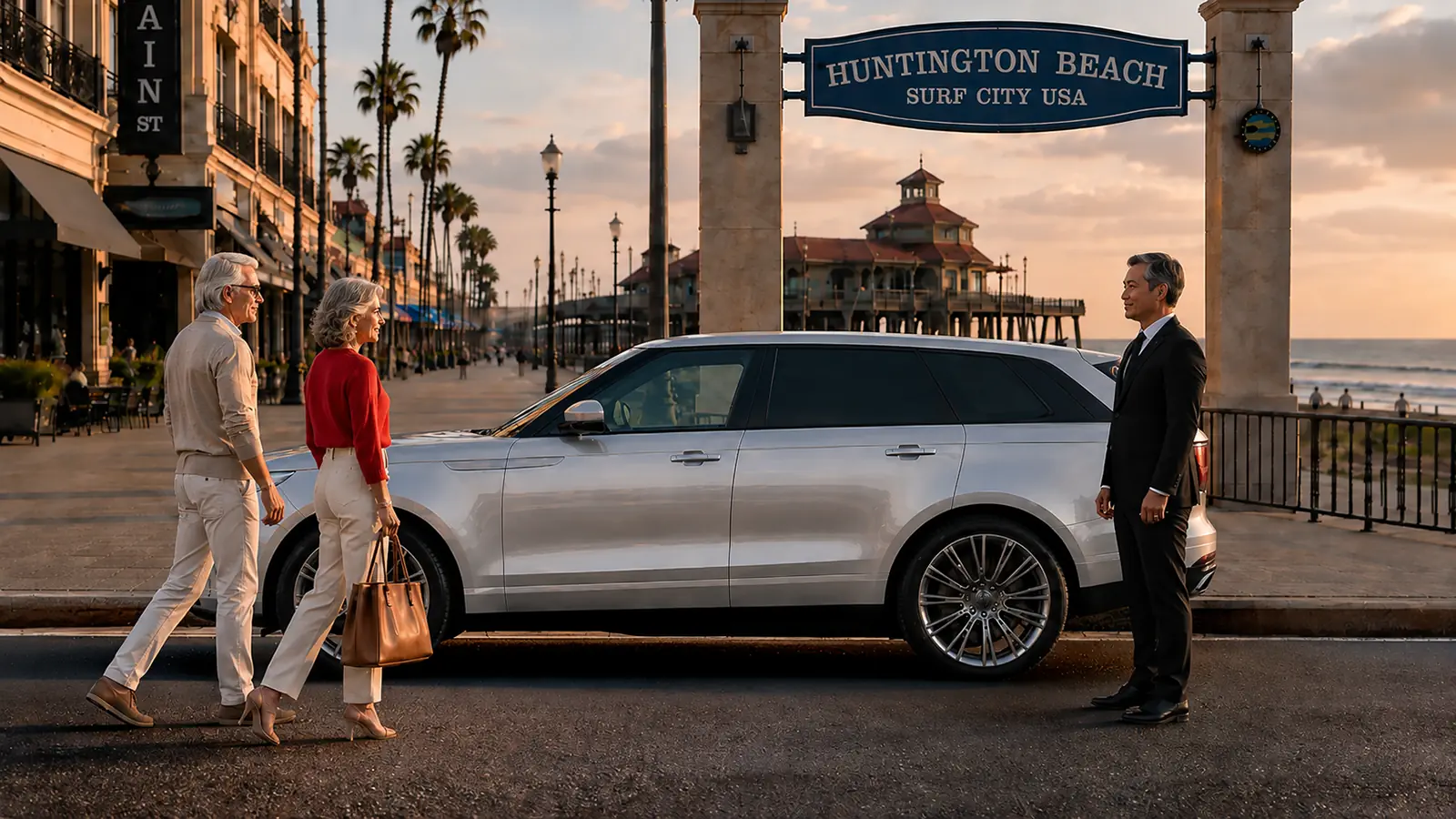
Huntington Beach driving can look casual until parking and event timing become the hard part. We send a private driver to operate your own vehicle across Surf City and the rest of Orange County.
Service Area · Serving Huntington Beach and all of Orange CountyHover to pause and read
Touch to pause and read
The six bands are Harbour, Bolsa Chica, North Shore, Pier-Downtown, South Shore, and Inland. Harbour covers the water-linked residential branch near Warner Avenue. Bolsa Chica identifies the reserve and the state beach separately. North Shore runs through the Seapoint and Goldenwest area. Pier-Downtown centers on Main Street. South Shore continues toward the Santa Ana River. Inland reaches Central Park and the 405.
Every band receives an action. A Harbour entry identifies a gate or island street. A Bolsa Chica entry chooses the reserve or beach. A North Shore entry names a lot or cross street. A Pier-Downtown entry identifies a structure or event boundary. A South Shore entry uses a state park lot. An Inland entry selects the street spine that actually reaches the appointment.
The ocean is only the western edge of Huntington Beach. A schedule beginning near the 405 can cross several miles before it reaches Pacific Coast Highway. Beach Boulevard, Edinger Avenue, Warner Avenue, Goldenwest Street, Magnolia Street, Brookhurst Street, Adams Avenue, and Yorktown Avenue divide that width into recognizable local paths.
The Zone Card shows the inland starting point before the ocean destination. It also preserves the return direction. A waterfront lunch followed by an Edinger Avenue commitment is not written as two nearby Huntington Beach stops; it is written as a full cross-city change from Pier-Downtown to Inland. The vocabulary exposes distance that a city name alone would hide.
PCH joins the coastal bands but never identifies the destination. Every entry adds the actual reserve lot, beach gate, Pier boundary, property entrance, or cross street.
"We have built our reputation one client at a time. If any part of your experience falls short of what you expected, I will make it right. You have my word, and every client has my mobile number."
Warner Avenue reaches two locally distinct destinations near the coast. West of the main inland grid, it serves Huntington Harbour and the public boat-ramp area. Near Pacific Coast Highway, it also reaches the north parking area and Interpretive Center for Bolsa Chica Ecological Reserve. Those uses must occupy separate Zone Card entries.
A client heading to the reserve needs the north-lot instruction. A household appointment in the Harbour needs the exact residential branch, gate, and street. A boat-ramp meeting needs the facility address. Writing only “Warner near PCH” leaves all three possibilities open, so the Zone Card adds the named destination before the automobile reaches the final coastal intersection.
California's wildlife agency lists the south parking area for Bolsa Chica Ecological Reserve at 18000 Pacific Coast Highway. It explains that direct entry is made from the northbound side. A southbound approach continues to a lawful reversal point and returns north rather than attempting a prohibited turn into the lot.
The Zone Card records South Reserve Lot, northbound approach, the pedestrian bridge or trail reference, and the expected return time. This is a place-specific decision created by the actual entrance geometry. It should not be replaced with a general promise to meet beside the wetlands, because the person and automobile could otherwise remain on opposite sides of Pacific Coast Highway.
The reserve's north parking area is adjacent to the Bolsa Chica Interpretive Center on Warner Avenue near Pacific Coast Highway. The wildlife agency gives separate turn instructions for northbound and southbound PCH approaches. The Zone Card labels this destination North Reserve Lot and Interpretive Center rather than treating it as overflow for the south lot.
A docent program, educational visit, or north-lot trail walk begins from this Warner Avenue reference. The end signal should identify whether the client returns to the Interpretive Center or completes an authorized path elsewhere. The assigned employee does not assume that a trail description changes the automobile location. The recorded lot remains the reunion point until the client sends another lawful noun.
“Great experience! Communication was amazing. I will definitely use this service again”
★★★★★
Anne Hackett
Five-Star Google Review
Bolsa Chica Ecological Reserve protects an estuary, marshes, dunes, and nesting habitat. The state wildlife agency prohibits dogs and bicycles and restricts drones. It also notes that active oil operations can close some areas. The Zone Card therefore includes the current reserve notice reviewed for the visit and the activity the client expects to complete.
Items that cannot enter under the reserve rules remain secured in the household automobile. The client carries only what the permitted outing requires and follows marked trails and agency controls. If a portion closes, the person does not create an unofficial exit across protected ground. The updated reunion remains at an authorized north or south lot named in the card.
Bolsa Chica State Beach and Bolsa Chica Ecological Reserve sit near each other but serve different activities under different public authorities. One Zone Card entry says State Beach and includes the selected park entrance or lot. Another says Ecological Reserve and includes North Lot or South Lot. The shared Bolsa Chica name never replaces the operating noun.
This distinction controls belongings and timing. A beach gathering may involve towels, chairs, food, and shoreline equipment. A reserve visit follows habitat rules and a trail plan. When the day includes both, the card writes two stops and the lawful highway transition between them. The client can see exactly where the automobile changes from beach parking to reserve parking.
Huntington Dog Beach is associated with the shoreline between the Seapoint and Goldenwest area. That North Shore band is separate from the Pier crowds to the south and the Bolsa Chica destinations farther north. The Zone Card states Dog Beach, the chosen lot or metered area, the cross street, the dog's equipment, and the final collection reference.
Wet coverings, water, leashes, cleanup supplies, and a protected interior area can be prepared in the client's automobile before departure. The public rules and posted parking controls remain decisive. If the party walks beyond the original cross street, the new finish is named before the automobile moves. A location dot alone does not identify which side of PCH offers lawful access.
Seapoint Street connects a residential edge, North Shore parking, and routes toward Goldenwest Street. The Zone Card uses Seapoint as a pivot only when the exact destination sits on that branch. A residence receives a street number and entry; a shoreline meeting receives a lot or coastal marker; an eastbound continuation receives the next named spine.
That precision is useful after a northern beach visit. The automobile might continue inland toward Central Park, turn south toward downtown, or proceed north toward Bolsa Chica. The card records the chosen branch while everyone is still together. “Leave from Seapoint” becomes a complete local decision rather than an invitation to search several nearby blocks.

Goldenwest Street is one of Huntington Beach's strongest north-south connectors. It touches the coastal band, passes residential districts, and reaches Huntington Central Park. The Zone Card divides those uses into Goldenwest Shore, Goldenwest Residential, and Goldenwest Central Park so the street name never stands alone.
A Central Park program followed by sunset near the water creates two Goldenwest entries with different exits. A vetted W-2 employee records the park-side facility first and the shoreline cross street second. If the order reverses, the card shows the inland return before coastal parking fills. This named-spine method belongs to Huntington Beach's wide, comparatively level geography.
The Huntington Beach Pier meets Pacific Coast Highway at Main Street, and Pier Plaza becomes an event coordinate for many downtown gatherings. The Zone Card records the event name, public access notice, approved pedestrian approach, fixed attendance time, and lawful automobile position outside any closure. It does not promise that an ordinary Pier curb survives an event overlay.
Someone can finish on the Pier, at Pier Plaza, beside a beach lot, or on Main Street. Those are separate reunion nouns. Before the visit, the client selects one and adds a stable landmark. If barriers or public personnel change the plan, the new point is confirmed before the party leaves the original pedestrian area.
The Main Promenade Parking Structure is located at 200 Main Street between Walnut and Olive Streets. Downtown information identifies entrances from Olive Avenue and Walnut Avenue. The Zone Card therefore records Main Promenade, Olive entrance or Walnut entrance, interior level, pedestrian exit, and the direction needed after downtown.
The two entrance names are more useful than “park near Main.” A lunch on one side of the downtown blocks and a later inland appointment can favor a different structure movement from a Pier visit followed by a hotel. If the automobile is repositioned while the client remains downtown, the new level and exit replace the earlier card fields immediately.
Downtown Huntington Beach currently schedules Surf City Nights on Tuesday evenings along Main Street between Pacific Coast Highway and Orange Avenue. The street-fair arrangement closes the central portion to ordinary automobile movement during the program. A Tuesday Zone Card therefore carries the event boundary instead of copying a non-event Main Street instruction.
A restaurant or store inside the closure is paired with a walk-out street and a structure reference. The assigned employee does not wait within the pedestrian program. When the party is ready, the client identifies the chosen boundary and any purchases that must be loaded. Current signs and organizer instructions control if the footprint or timing changes.
Pacific City is listed at 21010 Pacific Coast Highway, but its parking access is associated with Pacific View Avenue between First Street and Huntington Street. The Zone Card separates the property's public address from the automobile entrance. It also identifies the selected store, restaurant, or meeting point inside the property.
A party can enter from one side and finish nearer another. The card therefore adds the pedestrian reunion point rather than relying on the retail center's name. A later hotel, Pier, South Shore, or inland commitment determines the most useful exit. Property personnel and current garage controls govern automobile access throughout the visit.
Huntington City Beach parking uses named approaches in the Pier-Downtown and South Shore area. Local visitor information identifies First Street, Huntington Street, and Beach Boulevard as beach-lot entrances, subject to active conditions. The Zone Card records the selected gate and lot segment rather than describing the automobile as somewhere south of the Pier.
During an event, one gate can serve participants, vendors, officials, or no ordinary entry at all. The current event notice replaces the everyday card. At departure, the person identifies the same lot segment or a new lawful boundary before walking away. A gate name prevents the client from searching a long municipal parking field after the automobile has moved.
California State Parks describes Huntington State Beach as a two-mile shoreline extending from Beach Boulevard south to the Santa Ana River at the Newport Beach boundary. That clear geography gives the South Shore band its own start and end. It is not recorded as an extension of the downtown Pier lot.
The Zone Card adds the state park lot number, the nearest paved access, and the next destination after the beach. A person waiting at Lot 1 and another at Lot 7 are not at the same automobile point. Public park staff, gate signs, and current notices govern any change in lot availability or exit direction.
California State Parks identifies numbered day-use lots along Huntington State Beach. Its accessibility information also names paved beach approaches beside several specific lots. The Zone Card uses the posted lot number as the automobile noun and a nearby path or facility as the pedestrian return noun.
That pairing matters after a long shoreline walk. The person may see the automobile area from the beach path but still be several lots away. Before the activity begins, the client records the planned return lot and any authorized alternate. A change is communicated with the new lot number, not with a broad instruction such as “farther south.”
California State Parks identifies Spencer Ramps beside Lots 1, 2, 4, 7, 9, and 10. These broad paved approaches extend from the beach trail across the sand toward the high-tide area. The Zone Card writes the ramp reference and the automobile lot together because the ramp describes a pedestrian return, not a separate parking destination.
When a group selects Ramp 4, the automobile entry remains Lot 4 unless park personnel establish another lawful arrangement. A message mentioning only a ramp can leave the employee without the gate and row needed for the household automobile. The paired notation, Lot 4 and Spencer Ramp 4, preserves both halves of the South Shore reunion.

Huntington State Beach includes a Least Tern Natural Preserve near the southern day-use area. The Zone Card records the nearby authorized parking and marked public path without treating the preserve as a shortcut or gathering space. Current park boundaries and wildlife protections govern how the person approaches and leaves that portion of the shore.
A nature observation and a beach gathering therefore receive different nouns even when they occur on the same morning. The preserve entry identifies the public viewing context; the beach entry identifies the group's selected lot. That separation keeps equipment, automobile placement, and pedestrian movement aligned with the actual South Shore activity.
Huntington Beach maintains a large number of public fire rings along its beachfront. A gathering should identify the beach authority, nearby lot, approximate ring row, host contact, and planned extinguishing time. The Zone Card does not use “the bonfire” as a sufficient automobile destination when many groups may be visible from the same parking field.
The host sends the final departure signal after the group has completed its required cleanup and followed beach rules. Belongings are carried to the recorded lot rather than left at a highway edge. If public controls close or reassign an area, the replacement ring location and lot are updated together before guests spread along the sand.
The Talbert Flood Control Channel reaches the ocean within Huntington State Beach. State Parks notes paved paths on both sides of the channel extending toward the water. The Zone Card treats north side and south side as separate pedestrian references because the channel itself cannot be crossed casually at the sand-side end.
A family program or beach gathering near Talbert therefore receives a lot number plus a channel side. If the finish changes, the person returns through the correct paved path before requesting automobile collection. This local channel vocabulary prevents a meeting error that ordinary mileage or a moving map pin may not reveal.
The Santa Ana River forms the southern end of Huntington State Beach and the coastal boundary toward Newport Beach. A Zone Card entry near that end states Huntington State Beach, river side of the selected lot, and the intended inland connection. It does not use Newport Beach as shorthand for a location that remains inside Huntington Beach park geography.
The river also gives a long shoreline day a definite southern limit. When a client begins near the Pier and finishes toward the river, the two points remain separate entries with substantial movement between them. The automobile can then be positioned for the correct return toward Beach Boulevard, Brookhurst Street, or another named east-west route.
Huntington Harbour contains islands, channels, bridges, marinas, gated properties, and waterfront streets. A Harbour Zone Card uses the full residence or facility address, branch street, gate or call-box instruction, authorized contact, and automobile placement. A dock name or island reference can supplement the address but cannot replace it.
The client also identifies who may authorize entry. The assigned employee does not follow another automobile through a controlled gate or assume that a waterfront path reaches the residence. At the end, the card states the exact home entrance and requested automobile position. Reaching Warner Avenue is not the same as completing a Harbour return.
Two waterfront addresses can appear close across a channel while their street connection follows a bridge and several turns. The Zone Card preserves the actual residential branch instead of estimating from straight-line distance over water. This is particularly important when a dinner, vessel arrival, or household gathering has a fixed finish.
If the party moves to another Harbour address, the new branch is added before the automobile leaves its current lawful position. The water view does not establish automobile access. Street geometry, gates, bridge connections, and the named property determine the handoff. That decision pattern is unique to the Harbour band.
California's boating-facility directory lists the Huntington Beach Boat Ramp at 3831 Warner Avenue. The Zone Card uses that complete facility name and address, then adds the dock or boarding reference supplied by the client. It does not combine the ramp with a nearby restaurant, marina, or residential gate.
A launch or return can change with water conditions, equipment handling, and the responsible vessel contact. The household automobile remains in a permitted position under facility rules. The client sends the actual shore-side end signal before collection. The ramp entry can then connect to a Harbour home, Sunset Beach, or an inland commitment without losing its specific Warner Avenue purpose.
Sunset Beach extends along Pacific Coast Highway at Huntington Beach's northern coastal edge. Its narrow pattern differs from the broad downtown grid. A Zone Card entry uses the exact business, residence, beach access, or Pacific Avenue reference together with the automobile direction and the next coastal boundary.
The same schedule may touch Sunset Beach and Huntington Harbour, but the two names are not merged. One follows a linear PCH and Pacific Avenue pattern; the other branches through channels and residential streets. Separating them helps when an evening starts at a Sunset Beach address and ends behind a Harbour gate.
The city lists Huntington Central Park at 18002 Goldenwest Street. The large inland park includes facilities and activities on more than one side of Goldenwest. The Zone Card names the exact building, program, field, nature destination, or meeting area and then records the side of the park used by the automobile.
A person leaving the Central Library should not be expected at a distant recreation area merely because both are inside Central Park. The same rule applies to a walking program that begins and ends at different park edges. Each facility receives its own release signal and lawful automobile point. “Central Park” remains the zone, not the final instruction.
Huntington Beach Central Library is located at 7111 Talbert Avenue within the Central Park setting. A library appointment can involve the main entrance, a meeting room, cultural program, research visit, or another announced gathering. The Zone Card records Central Library, Talbert Avenue, the program name, and the expected exit.
If the client continues elsewhere in the park, that becomes a second card entry rather than an assumed walk through the campus. A later Goldenwest, Gothard Street, or Beach Boulevard commitment also receives its own spine. This preserves the library as a precise building and not a synonym for the entire park.
Edinger Avenue reaches the Inland band near Interstate 405 and Bella Terra. This is a very different Huntington Beach environment from Main Street or Pacific Coast Highway. The Zone Card states the named business or building, property entrance, interior meeting point, parking position, and regional direction after the stop.
An Edinger appointment followed by the Pier is a westbound cross-city sequence. A downtown morning followed by Bella Terra is an eastbound sequence that must protect the 405-side deadline. The card keeps that direction visible and prevents the ocean from dominating an itinerary whose hardest commitment may sit at the inland edge.
Bella Terra is located at 7777 Edinger Avenue near the 405. The property contains many businesses and several automobile approaches, so the Zone Card adds the exact destination inside the center. A store, cinema, restaurant, office, or gathering cannot be reduced to the center's name when different entrances release people onto different sides.
Packages and personal items can remain in the client's automobile when appropriate. If the automobile is repositioned, the assigned employee sends the new property-side reference before the client exits. Property controls govern every garage or surface area. The next Zone Card entry decides whether departure continues along Edinger, uses Beach Boulevard, or returns west.
Share a live tracking link with anyone you choose so they can follow your vehicle's location in real time.
Reach your driver by cell.
Reach our Chairman and CEO by cell.
Beach Boulevard connects Interstate 405, inland businesses, residential blocks, and the state-beach entrance at Pacific Coast Highway. The Zone Card uses a complete address and cross street because “on Beach Boulevard” can describe a long portion of Huntington Beach. The boulevard name supplies the spine, not the destination.
The fixed appointment determines whether optional coastal activity belongs before or after it. When the day moves south to Huntington State Beach, the card names the park gate separately from the inland boulevard stop. When it moves north or east, the next cross street is written before departure. That prevents a single famous road from swallowing several distinct commitments.
Adams Avenue, Magnolia Street, and Brookhurst Street organize residential and daily activity south and east of downtown. They also offer different ways to connect an inland address with the South Shore band. The Zone Card chooses among them from the actual street number and next required arrival, not from a generic preference for a familiar road.
A residence near Adams followed by a state-beach lot creates one branch. A Brookhurst address followed by the Santa Ana River end creates another. A Magnolia commitment can reach a different part of the shoreline. Naming the spine beside the zone provides local vocabulary that cannot simply be copied to another Orange County coastal page.
The Pacific Airshow can place a large event footprint along the Pier-Downtown and South Shore bands. On the event date, the Zone Card is rebuilt from current organizer and public-agency instructions. It records the approved arrival boundary, pedestrian approach, ticketed or hosted location, release window, and lawful automobile position outside restricted streets.
Ordinary beach gates or downtown curbs may serve different purposes during the program. The assigned employee does not promise an event-side collection that public controls remove. The client and authorized contact select a replacement noun before leaving the viewing area. The event overlay expires after the program; it is never copied into an ordinary weekend plan.
The US Open of Surfing centers activity near the Pier and south-side beach area. Its Zone Card begins with the official event notice for that year, not a parking memory from an earlier tournament. The card then identifies the competition area, downtown structure or lawful lot, pedestrian route, and agreed reunion boundary.
A competitor, sponsor guest, family, or spectator may carry very different belongings and follow different access instructions. Those facts are recorded without assuming access to a restricted event area. If a session ends early or the crowd releases in stages, the authorized person sends the new end signal while the assigned employee remains in a permitted position.
Begin with the two commitments farthest apart in local logic: Harbour to South Shore, Bolsa Chica to the 405, Central Park to Pier-Downtown, or Sunset Beach to the Santa Ana River end. Identify the fixed arrival, then add every named entrance, gate, structure, lot, and release signal between those points.
Next provide the automobile, key location, passenger count, belongings, authorized contacts, and required final placement. The company can organize the remaining stops around the immovable fact. The finished plan is a Huntington Beach Zone Card built from six bands, named cross-city spines, reserve turn rules, state-park lots, Harbour branches, Pier overlays, and the client's actual doorway.
Search our answers, or jump straight to the questions people ask.
See all questions →The pier and Main Street, Pacific City, Huntington Harbour, Seacliff, Edwards Hill, Sunset Beach, and the waterfront resorts along Pacific Coast Highway, with the Surfing Walk of Fame and Huntington Central Park nearby.
John Wayne as the natural choice, Long Beach also practical from the north Orange County coast, and LAX when the flight schedule requires it.
Huntington Beach is classic Orange County beach driving: Surf City energy, pier parking, Main Street timing, PCH traffic, big event weekends, and Huntington Harbour pickups where the casual feel can hide how hard the drive home becomes.
Your Car Our Driver serves Huntington Beach and every community across Orange County, Los Angeles County, and Riverside County.
Your own sedan or SUV starts at $60 / hour, larger vehicles at $66 / hour, with a three-hour minimum on every booking, a five-hour minimum for reservations beginning at or after 6:00 p.m. on New Year's Eve. No surge pricing, ever.
See full pricingYour car, driven in Huntington Beach.
Reserve a private driver for an airport run, an evening out, an appointment, or a recurring schedule. For other communities we serve, see our Client Communities, or visit our FAQ for common questions.